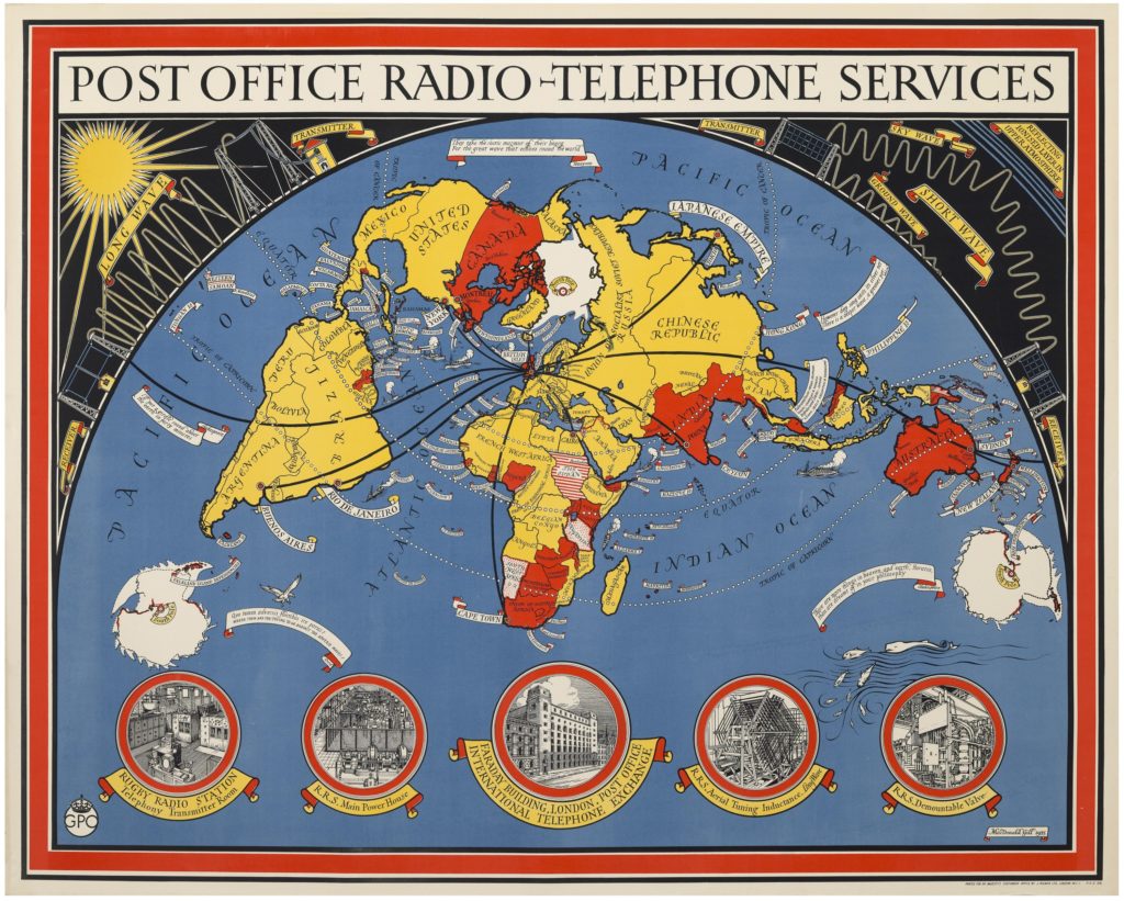
This 1935 map showing ‘Post Office Radio-Telephone services’ by illustrator and cartographer Macdonald Gill shows the General Post Office’s global network of wireless two-way voice connections.
Macdonald Gill was a sought-after mapmaker in the early twentieth century. He also designed the 1914 “Wonderground Map” of London and the 1946 “Cable & Wireless Great Circle Map”. The map is a lithograph print designed for the Post Office and printed by J. Weimer Ltd.
“the diagrams of transmitters and wavelengths across the top, and the illustrations of radio telephone facilities below, are decorative and instructional, while also promoting the organizational might and technical prowess of the GPO (General Post Office).”
“when the British government decided after the First World War to construct the “Imperial Wireless Chain” connect its global empire, control was assigned to the GPO…. By the 1930s the GPO was a global telecomms colossus and, not coincidentally, a pioneer in marketing communications.”
Description on the Boston Rare Maps Inventory.
Who shared this example?
-
Chris Mourant
Dr Chris Mourant is Lecturer in Early Twentieth-Century English Literature at the University of Birmingham. He researches twentieth-century literature and culture, with particular focus on modernism and networks of transnational connection, communication, and exchange.